Length: 1.25 miles. Trail Map & Trail Description
Access: To reach the trailhead, follow Rte. 190 east 2 miles from the center of Somers to Randell Road. Turn left on Randell, then Left on Lance and right on County Road. The small parking area is located on the left just past 159 County Road.
NOTE: Hunting is allowed on adjacent state land so please wear bright clothing and use caution during hunting season.
Length: 1.2 miles. Total distance from Whitaker Woods parking area to summit of Soapstone: 3.2 miles. Trail Map and Trail Description
Overview: The Forest View Trail connects the Northern Connecticut Land Trust’s (NCLT) Whitaker Woods property on Wells Road in Somers to trails on Soapstone Mountain with access to the summit.
Access: Although the trail crosses Mountain View Road, it is not recommended that hikers park there due to limited parking and poor sight lines for cars coming down Mountain View Road. Better options are to park at Whitaker Woods and hike uphill to Soapstone Mountain with a car spotted at the upper or lower Shenipsit State Forest Soapstone parking areas off Gulf Road, or an up and back hike from Whitaker Woods.
Allowed Uses: Hikers & Horse riders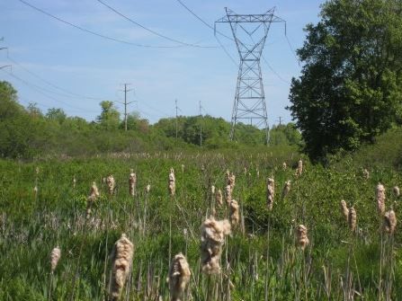
Length: 0.5 miles.
Difficulty: Easy
Overview: NCLT’s Scantic Riparian Area Nature Preserve is located off of Durkee Road in Somers and is open to the public for walking or horseback riding. It is an outstanding location for birding and there is also beaver activity in the area with a beaver dam and at least one lodge. The former loop trail along the river is closed due to periodic flooding as well as a broken footbridge. A walk of about a half mile along the powerline maintenance road leads past cattail marshes. Complete Trail Description.
Access: Park under the powerline tower on Durkee Road just west of the Scantic River bridge. Walk around the locked gate across the road to access the area.
Allowed Uses: Hiking and horse riding. Due to the large bird population please leave Fido at home when visiting the area.

Length: 1.5 mile loop.
Difficulty: Easy to moderate
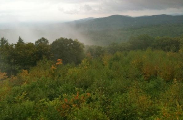
Overview: The Skyline Scenic Area offers a 1.5 mile trail loop with a broad, panoramic view across the Connecticut River Valley on clear days from the scenic overlook. The trail is well-marked with yellow plastic diamonds. The shortest way to the lookout point is to the left from the parking area. This half mile section, known as the Ledge Trail, includes a steep, rocky section that may be treacherous when wet, snow covered, or icy. To the right from the parking area is the much easier, mile-long section leading to the same lookout. Complete Trail Description.
Access: The small Skyline Scenic Area parking area is located on the north side of Stafford Road about 0.2 miles west of the intersection with Root Road. It is not plowed in the winter.
Allowed Uses: Non-motorized trail open to hikers
Length: A total of almost five miles of trails have been built which create the opportunity for several loop hikes of various length and difficulty. Trail Map
Difficulty: Varying from easy to moderate
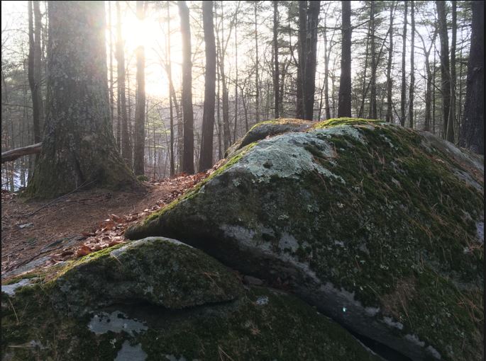
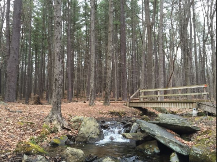
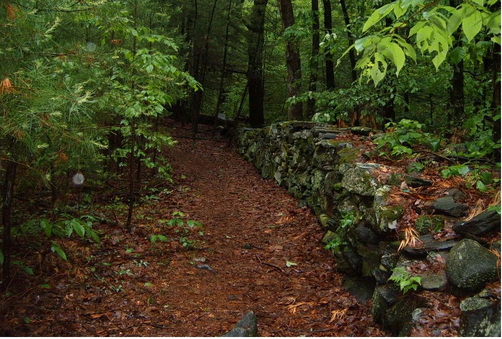
Overview: Whitaker Woods is a unique 266 acre property in the center of Somers that is pristinely maintained. The land is characterized by a variety of terrain with the network of trails taking you past stonewalls, over brooks, through stands of mature white pine, and across open fields. The main trail is the Old Forest Loop which starts and ends at the Wells Road parking area. This 1.8 mile long trail follows old woods roads for almost its entire length with steady climbs to its highest elevation at the top of the loop whether walked clockwise or counterclockwise. All the other trails are accessed from the Old Forest Loop, branching off at various points.
Access: Parking lot near 80 Wells Rd.
Allowed Uses: No motorized vehicles. Hikers are asked to keep dogs leashed and under control at all times. All trails except the Overhill Trail and Under Hill Trail are also open to horses and riders.
Length: 1 mile to 1.6 miles. Trail Map
Difficulty: Easy to moderate
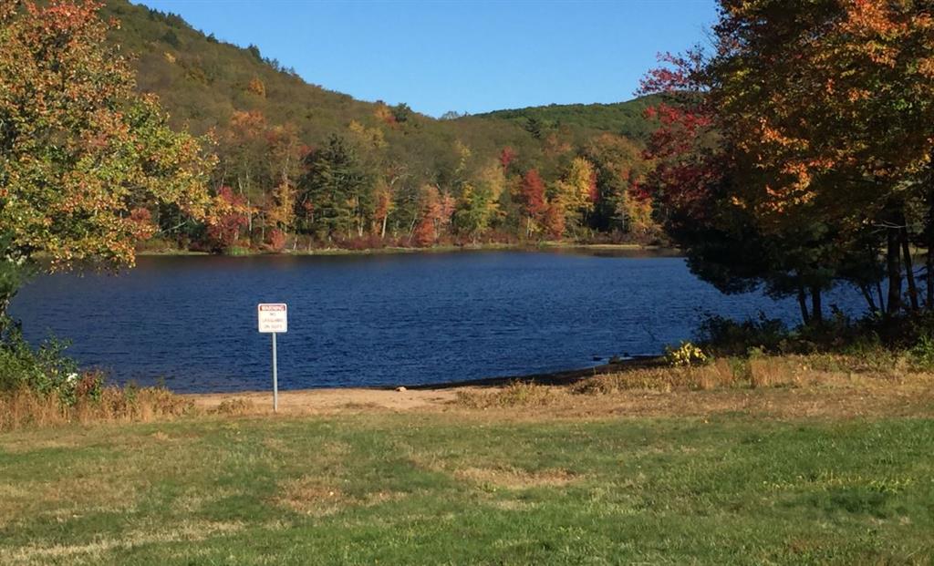
Overview: Camp AyaPo consists of 178 acres formerly owned by the YWCA and purchased by the town of Somers in 2014. There are several trails located on the property – one that encompasses Hurds Lake and others leading to the summit of Perkins Mountain.
Access: Take Route 190 to Battle Street just east of the Route 190 intersection with Route 83. After several miles, Battle Street turns into Mountain Road. Remain on Mountain Road and take a left on Camp Road and look for the parking area on the left.
Allowed Uses: This property is open during daylight hours for non-motorized passive recreation activities both on the trails and on the water. All trails except the Lakeside Trail are multiuse trails open to equestrians and mountain bikers as well as hikers.
Hurds Lake can be used for fishing and limited kayak or canoe use. A small boat ramp is located at the west end of the dam. Hurds Lake is not tested by the LHD and there is no lifeguard on duty, swim at your own risk.
- Open Sunrise to Sunset
- No trespassing after dark
- Cleanup and remove all trash
- No motorized vehicles
- No motorized boats
- No fires (including grills)
- No shooting
- No hunting
- No camping
- No alcohol
- Dogs must be on leash at all times
Difficulty: Easy
Overview: The popular beautiful, hilly, 84 acre McCann Family Farm stretches from near the center of Somers on Route 190 up the northwestern slopes of Soapstone Mountain. Two marked trails are maintained as well as several unmarked paths. The 1.95 Shady Brook Trail (blue diamonds) stays in the northern 2/3 of the property, while the 3.0 mile Jerry Stage Trail (yellow diamonds) visits the southern boundary area.
Access: The entrance and parking area are located on the south side of Route 190 about 0.7 miles east of the light at Rt. 83 or 0.5 miles west of the light at Gulf Road.
SOMERSVILLE MILL TRAIL
Length: 1 mile from mill site to Bailey Road parking area. Trail Map.
Difficulty: Easy
Overview: This trail offers a pleasant walk along the Scantic River starting at the Somersville Mill site and following the south side of the river into Enfield where it connects to a Connecticut DEEP trail and continues to the Scantic River State Park parking area on Bailey Road. The trail is marked with yellow diamonds and follows along the river bank for much of its length. At the far end be sure to take time to look at the ruins of the dam and canal which supplied water for the Powder Hollow munitions factory.
Access: A small parking area is located at the site of the former Somersville Mill on Maple Street just past the south end of the Scantic River bridge. The trail can also be accessed from a DEEP parking area on the north side of Bailey Road off Rte. 191 in Enfield.
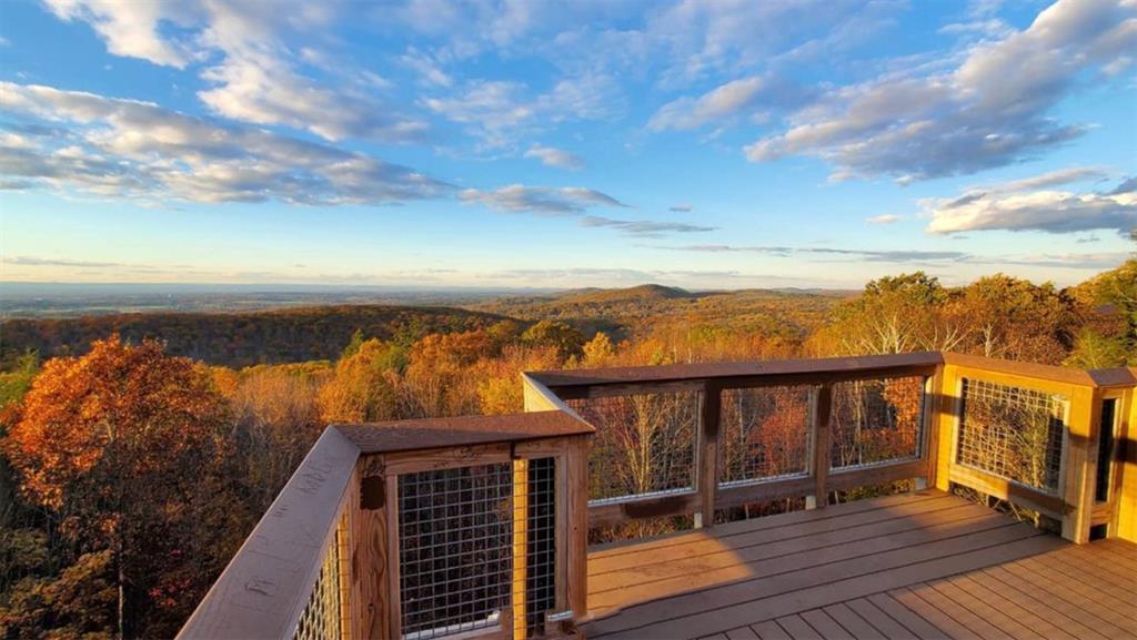
While the original fire tower is long gone, today’s tower stands specifically for the public’s recreational viewing. From this vantage point, take in spectacular vistas from the Connecticut River Valley to the Springfield skyline.
